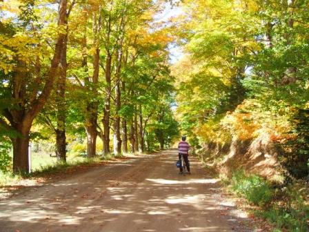
It's not the Alps, it's not the Rockies , it's not even the Cabot Trail
but the North Mountain of the Annapolis Valley is very accessible but
often missed by the many bicycle tourists from the "Boston States" who
come this way via the Yarmouth ferries. Maybe someday this will be a
section of my Bike Tour Book
Refer to Map Book of Nova Scotia pgs. 3,8 and 13.
This range is the north wall of the Annapolis Valley (hence the name), separating the Valley from the Bay of Fundy. It creates the local climate by shutting out the cool winds and fog from the Bay.
The western end sticks out into the Bay of Fundy forming Digby Neck, Long Island and Briar Island, subject of another bicycle trip. The Bay also cuts through at Digby Gut forming the Annapolis Basin. The eastern end is the Blomidon Peninsula at the entrance to Minas Basin
The south, or valley side is very steep rising over 200 meters. The north or bay slope descends gradually for about 5km. Right at the Bay there are usually cliffs about 20m high, with only a few coves. In summer one can expect a 10 C drop in temperature between the Valley and the Bay. Unfortunately there is often fog which limits the fantastic views along the Bay.
Of course the tides in the Bay are among the highest in the world. At low tide boats at the wharfs sit on dry land. The water temperature reaches a maximum of 10 C ( in September) so swimming is rather chilly.
Most of the roads across are paved, most of the gravel roads are pretty smooth, a few have some rough sections. A mountain bike is not needed but low gears ( 30 x28 ) and wider tires ( 32mm) come in handy. I prefer climbing on gravel to descending on it. I also prefer to climb up switch backs and descend on straight roads. So I have indicated the best direction to bike some of these roads.
Note that what usually is a good hard packed gravel road can be loose gravel after it is graded.
There are very few stores on the mountain or in the shore villages. There are small stores in Parkers Cove, Port George , Margaretsville, Hall's Hbr. ,Scots Bay and The Lookoff. There are restaurants in Margaretsville, Harbourville, Hall's Hbr.
Starting in the west:
This is a fairly gentle climb through the Hollow. Port Royal has the historic Habitation of 1604. Delaps Cove is the west end of the paved shore road . The actual cove and fishing village is about 1 km west of the junction.
A moderate climb staring about 4 km from Annapolis Royal, would make a nice 30 km loop with the Delaps Cove road in either direction.
This is a big one! Its best done going north. There are 2 switch backs with a grade averaging 10%. A Provincial campground is at the top. Then it's a straight run down for about 4 km to the shore road. The village with lighthouse and wharf is about 1 km west of the junction. The Clarence Road runs along the base of the mountain to near Middleton. The Arlington Road is paved along the crest of the ridge to Mt Rose (about 7 km)
The BIGGEST. This is the tallest climb of any paved road on mainland Nova Scotia. On Cape Breton only 2 climbs are bigger. It also has the killer kilometer. The first km climbs 130 m ( ie averages 13%) so I think this is the steepest kilometer in Nova Scotia.There are 2 switchbacks . Going south down this is scary. There is no runout leading to the STOP sign at a T junction!
At the fields on the top there is a great view of the Bay. Just over the top is a junction with the paved "shore" road. Go left down to the Bay at Port Lorne. Right leads to East Arlington, Mt. Hanley and Port George. 2 km from the junction there is a gravel lane on the right which leads to a nice clear Sandy Lake (GR= E25N77) where one can have a refreshing swim after a hot climb.
The Arlington Road is paved to the Bridgetown-Hampton road along the top of the ridge.
Makes a nice loop with the Mt Hanley or P. George or Margaretsville roads.
NOTE the Map Book shows a paved road from Clarence East to East Arlington . THIS DOES NOT EXIST!!
A medium climb, good in either direction. From Cottage Cove it's a nice flat ride to Port George
This is the easiest climb and Margaretsville is one of the nicest shore village with small restaurant. Traffic is heavier on this road. Paved "shore" road west to Port George .
Just before climbing you pass Spa Springs , site of a famous mineral springs resort in the 1800s.
About 2 km off Rt 362 at Victoria Vale is "Daydreams and Destinations Tea House" a very quaint place servering light lunches and deserts. Closed Sundays and Wednesdays. Turn near Sunvale campground (swimming pond). Restaurant is on Ruggles road.
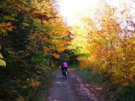
This is for lovers of wild, rough roads. Although a MTN bike would be useful it is not necessary as only 2 km is really rough and only about half a km is steep. This is very pretty in October as the road goes deep into maple woods.
Vault Road is the West side of the "square" in Melvern Square. The lower section back to Rt 1 is paved. There is a slight jog to right, then left where the pavement ends . The next 3 km is smooth and flat. After the last house the road is little maintained as it enters a canyon called the Vault. Then there's a steep but short section that is usually eroded. Walking is advised . Coming down this would be very tricky as there is usually a strip of soft sand at the bottom. After the steep section is a flat zone that is often covered with mud puddles.
About 5 km out it crosses Forest Glade Rd, a smooth gravel road. One can continue on straight on gravel to Margaretsville or turn right, then after 1 km left on the paved road down to Margaretsville.
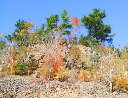
There are legends of a cave in the cliffs of The Vault that
leads deep into the bowels of the earth. Read:
Legend of the Vault, by Charles GD Roberts
Photos: Vault Road
Upper part of Vault road
Cliffs in The Vault
A fairly steep road. Melvern Square is a very pretty village. About 1 km out there is a strange illusion that the road is going down when you feel you are still climbing. Then it gets really steep. Now one decides to go left to Margaretsville or right to East M'ville. From the top it's a nice 4 km run down to M'ville.
Turn right 2km from M. Sq. Steeper than the west road. There used to be a herd of bison in fields on the top. After the top there is a gravel road right to the Bishops Mtn . From E. M'ville it's a 4 km paved road to downtown M'ville.
Very steep with loose gravel . Top is more easily reached via East Margaretsville Road. The road down to the shore road is relatively good The gravel shore road continues to Morden
Steep and straight. Morden is where Acadians fled across the Bay in 1755.
Steep and straight. The actual cove is 2 km down a dirt road from the village of Victoria Hbr.
Quiet a steep but straight climb. Preferable to go south from the Bay since then one climbs the 2 km gravel section. However, after speeding down the hill one meets a STOP sign at the T junction of Rt 221. About half km from shore road leads west to Ogilvie Wharf. East along the shore leads to Harbourville.
Very steep with 2 switchbacks , one very sharp. Posted Advisory Speed is 15 km/h ! Coming down not recommended. It's better to come down Long Point Road. It's a very nice 6 km run down to Harbourville with a great view of Isle Haute in the Bay.
There is a restaurant in Harbourville, specializing in German food and ice cream desserts.
Not as steep as H'ville road and better coming down. From C. Creek it's 1 km of gravel to Black Lighthouse and then another 5km of rolling hills to H'ville. Roads to East , towards Hall's Hbr. are usually rough and steep.
Very steep , very loose gravel, often deep ruts. For masochists only. It's hard to walk up the loose gravel. The first 2 km to the Thorpe Rd are OK , where one can continue east along the base to Northville. At the top this crosses the paved Mountain Front Road. It is another rough 5 km down to the Bay where there is a very scenic cove
An alternate road is the BURGESS MOUNTAIN ROAD, about 3 km west of Pelton Mtn Rd. It starts from Woodville Road. The first 1 km is paved, then it is a good but very steep gravel road for 3 km. High Point 220 m. Then it joins the Brow of Hill (Mountain Front) Road about 1 km east of Ross Corner. The Brow Road is paved from Halls Hbr Rd to Ross Corner - 8km (May 1998) There are 2 roads down to Chipman Brook on Bay of Fundy. The west road, from Ross Corner is better condition than the east (Pelton Mtn) road.
This is quite steep and is has more traffic than most roads.
A new alternate road (especially coming down) is ROCKWELL MOUNTAIN ROAD. From Centreville go west on Rt 221 for 3 km, then right to Northville and up to the top where it joins 359 and Brow of Hill Road. This has much less traffic so when you come down you can take more road. It is also quite straight with a good runout at bottom.
The run down to the shore is a real joy, it seems to go on forever ! It's about 8km with great views of the Bay. The very end has a steep curve around the cove. There is a old fashioned general store and a lobster restaurant here , so expect more tourists here. Just after the top the Gospel Woods Road turns right to follow the top, with some rollers , past Glenmont to the Lookoff. There are some great views from this road, both of the Bay and the Valley.
This is quite a steep climb to Glenmont but it's OK coming down. At the top one has the option of going straight on the gravel BLACK HOLE Road but it is impossible to return from a black hole.
Turn left on Gospel Woods Rd , 1 km, then right down to Baxters Hbr. West it's a nice ride along the shore on a good gravel road, to Long Beach then back up to the Gospel Wood Rd.
The cove is down a little lane and is one of the prettiest coves on the shore . A waterfall comes down into the Cove which empties at low tide. There is a spectacular view of Cape Split from here.
The road east passes above the little falls and then about 2 km on packed gravel to the Black Hole Road.
Yes, it is possible to walk into the Black Hole and come out alive but you need the Topo Map (21H1) and a compass. It's a steep bushwhack in.
The map shows an old road parallel to the shore to Bennett Bay but it was impassable ( even by MTN bikes) due to alder bushes last time I saw it.
You can continue back up the gravel road to Glenmont , or turn east on a road which will lead to Arlington near the Lookoff
Very Steep. Also the heaviest traffic since this a popular tourist destination. It's usually nicer to take an alternate route up, say via Glenmont and Gospel Woods Rd or Delhaven and Stewart Mtn Rd. The view from the Lookoff is the most spectacular( hence the name). Hope it's a clear day! After a few rolling hills it's a nice downhill to Scots Bay .
In Scots Bay there is "DD's Dinette", an interesting restaurant with 1950's decor.
Beyond the end of pavement it's about 2km of good gravel to the wharf and the start of the Cape Split Hiking Trail.
The road up to the Provincial Park is very steep.
This is where it all ends but what an ending! Cape Blomidon is the major landmark of the whole area, rising prominently from the waters of Minas Basin.
The Stewart Mtn road is a good gravel road climbing up to the Scots
Bay road from near Delhaven.
Nova Scotia Touring Index
HOME